Geographic features of the location of the islands of Eurasia
Eurasia is the largest continent on our planet. It occupies about 54.3 million km2, which is 36% of the Earth's total land area. It includes two parts of the world - Europe and Asia.
Geography of the continent
Most of Eurasia is located in the northern hemisphere, although on 11about deepens into the southern hemisphere. The extreme continental points of Eurasia:
- northern - Cape Chelyuskin (Taimyr Peninsula, Russia);
- southern - Cape Piai (Malacca Peninsula, Malaysia);
- western - Cape Roca (Portugal);
- east - Cape Dezhnev (Chukchi Peninsula, Russia).
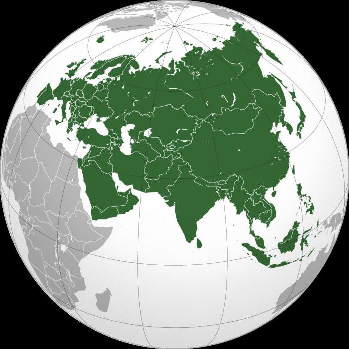
From the north the mainland is washed by the Arctic Ocean, in the west - by the Atlantic, from the east by the Pacific, and in the south by the Indian Ocean.
From other continents it is separated by straits andseas. North America is beyond the Bering Strait, Africa separates the Strait of Gibraltar, the Mediterranean and the Red Sea, where they are connected by the Suez Isthmus.
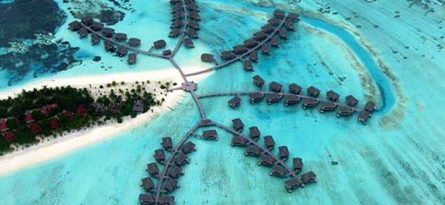
Islands of Eurasia
They surround the mainland with a semicircle. The islands and archipelagos of Eurasia are more concentrated in the eastern waters. But also in the northwestern part there are quite large individual islands or groups of islands.
In the main, the coarse archipelagoes are found in the watersPacific Ocean. The small ones are located in the Aegean Sea and the Atlantic Ocean. The Japanese archipelago (Honshu, Kyushu, Shikoku, Hokkaido), the Philippine Islands (Mindanao, Palawan, Luzon), the Malay Archipelago (Borneo, Sumatra, Java, Celebes), the British (Great Britain, Ireland) belong to the large archipelago.
Now about each in more detail.
The Japanese archipelago consists of four large and6848 small islands. The first four major - Kyushu, Hokkaido, Honshu and Shikoku - are 97% of the total area of the state, which is 377.9 thousand km2 (364.4 km2 land, the rest 13.5 km2 - water area). The islands themselves are of volcanic origin and are part of the Pacific Ocean volcanic fire ring, which is the result of the strongest earthquakes and tsunamis.
The Phillipines are washed by the western waters of the PacificOcean, consist of three large islands stretching from north to south. The state also includes 7638 islands. The total area of the entire territory is 299,764 km2.

The British archipelago consists of two largeislands (Great Britain and Ireland), archipelagos (they include the Hebrides, Orkney and Shetland Islands) and other small islands. The entire territory of Great Britain is isolated from the mainland by the Straits of Pa-de-Calais and the English Channel. Its total area is 325 thousand km2.
The Malaysian archipelago is located south-west of the Philippines and is washed by the waters of two oceans: the Indian and the Pacific. It is the largest archipelago in the world. Its total area is approximately 2 million km2. The largest islands are among the largest in terms of area in the world.
The largest island of Eurasia
The islands of Eurasia are scattered around the mainland, butthere are archipelagos. This is a conglomeration of a large number of islands in a relatively small area. In the central part of the Malaysian archipelago is the third largest island in the world and the largest island of Eurasia, Kalimantan. Borneo is his second name.

The island covers an area of 743 330 km2. An interesting fact is that this is the only island in the world that is divided into three states: Indonesia, Brunei and Malaysia.
Large peninsulas and islands of Eurasia
The peninsula is part of the land that is wedged ina certain distance into the adjacent waters of the seas and oceans and from all sides is washed by water, except one. This side connects the peninsula with the mainland.

"Record" of the world became the Arabian Peninsula, the area of which is 3.25 million km2. It is located in the south-west of Eurasia andalmost completely covered with desert sands. Behind him, with a large gap, is the Hindustan peninsula, located in the south of the mainland. Its area is 2 million km2. They are followed by Scandinavian, Yukotan, Balkan, Taimyr, Yamal and many others, whose area is much smaller.
Sakhalin is one of the largest islands in Eurasia. They are stretched from the north to the south. The area of the island is 76,400 km2. It is washed by the waters of warm Japan and the cold Sea of Okhotsk.
The island of Java is considered the most populated in the Malay Archipelago. Its area is 132 thousand km2 (land area 128,297 km2). About 120 volcanoes are located on the island, of which 30 are active. The total length from west to east is 1,000 km.
Sumatra is the island of the Malay Archipelago, washed by the Indian Ocean. It is the sixth largest in the world. The area is 473.481 km2 (including adjacent islands, the area of which is approximately 30 thousand km2). Quakes are frequent here, reaching an amplitude of 7-8 points.
</ p>